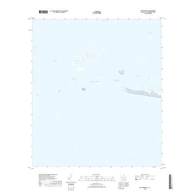
2018 Map of Bay Ronquille
USGS Topo · Published 2018About this map
The low-lying coastal marshes of Point Cheniere Ronquille define this reach of Plaquemines Parish, where the land fragmentizes into a labyrinth of salt bays and inlets. This 2018 survey documents a landscape dominated by the Gulf Of Mexico, showing the intricate network of water bodies including Bay Ronquille and Bay Long. The presence of the Robinson Canal and Bayou La Mer indicates the persistent human efforts to navigate and manage this shifting deltaic environment. Further inland, named features like Lake Grand Ecaille and Billet Bay illustrate the coastal geography just before it yields to more open water. This map is a record of the fragile transition between the Louisiana mainland and the sea, highlighting the various passes and bays such as Quatre Bayou Pass that allow tidal exchange throughout the marsh.
Find a feature on this map
13 named features on this map. Tap any name to fly to it.
Don’t see what you’re looking for? This feature index may not catch every label — zoom into the map to look around manually.
Map Details
Editions of this 2018 Bay Ronquille Map
This is the sole edition of this map. No revisions or reprints were ever made.
Other maps of this area

1892 · Quarantine
USGS Topo · 1:62,500

1893 · Fort Livingston
USGS Topo · 1:62,500

1935 · Port Sulphur
USGS Topo · 1:31,680

1935 · Bastian Bay
USGS Topo · 1:31,680

1935 · Bay Ronquille
USGS Topo · 1:31,680

1935 · Wilkinson Bay
USGS Topo · 1:31,680

1941 · Empire
USGS Topo · 1:62,500

1944 · Empire
USGS Topo · 1:62,500

1947 · Bay Ronquille
USGS Topo · 1:31,680
1947 · Wilkinson Bay
USGS Topo · 1:31,680