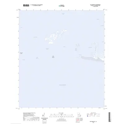
2024 Map of Bay Ronquille
USGS Topo · Published 2024About this map
Grand Terre Islands and the fragile barrier landscape of coastal Plaquemines Parish define this 2024 environmental study. The geography is dominated by an intricate network of saltwater bays and tidal passes, where the Gulf of Mexico meets interior waters like Bay Ronquille and Lake Grand Ecaille. Human modification is visible through the straight path of the Robinson Canal and the branching Bayou la Mer, which cut through the marshy terrain to support local maritime and industrial access. This map illustrates the contemporary shoreline at Point Cheniere Ronquille and the dynamic nature of Quatre Bayou Pass, providing a detailed look at the interface between the open sea and the sheltered wetlands of the Mississippi River Delta's western edge.
Find a feature on this map
17 named features on this map. Tap any name to fly to it.
Don’t see what you’re looking for? This feature index may not catch every label — zoom into the map to look around manually.
Map Details
Editions of this 2024 Bay Ronquille Map
This is the sole edition of this map. No revisions or reprints were ever made.
Other maps of this area

1892 · Quarantine
USGS Topo · 1:62,500

1893 · Fort Livingston
USGS Topo · 1:62,500

1935 · Port Sulphur
USGS Topo · 1:31,680

1935 · Bastian Bay
USGS Topo · 1:31,680

1935 · Bay Ronquille
USGS Topo · 1:31,680

1935 · Wilkinson Bay
USGS Topo · 1:31,680

1941 · Empire
USGS Topo · 1:62,500

1944 · Empire
USGS Topo · 1:62,500

1947 · Bay Ronquille
USGS Topo · 1:31,680
1947 · Wilkinson Bay
USGS Topo · 1:31,680