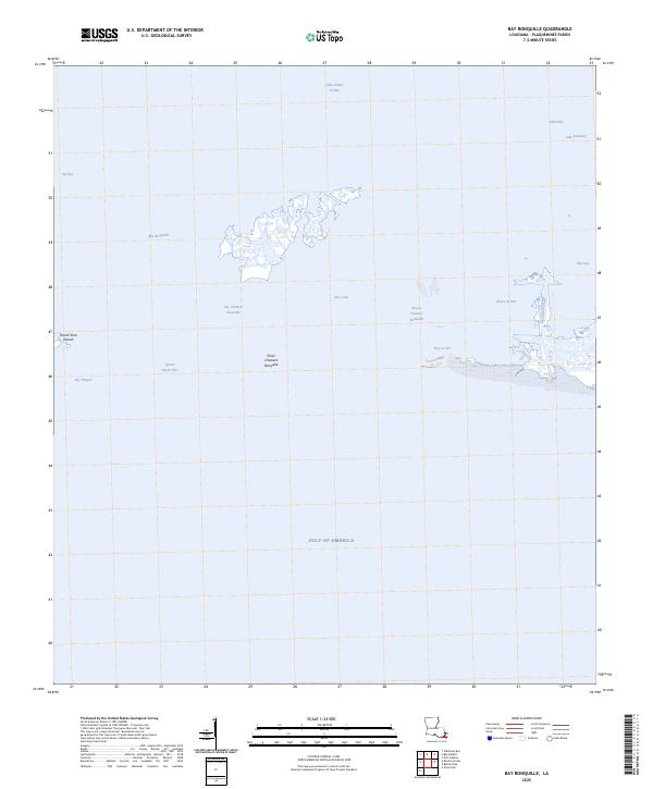
2025 Map of Bay Ronquille
USGS Topo · Published 2025About this map
Grand Terre Islands and the complex salt marshes of Plaquemines Parish characterize this 2025 coastal topography. The landscape is a network of interconnected water bodies such as Lake Grand Ecaille, Bay Ronquille, and Bay Cheniere Ronquille, where the distinction between land and sea is constantly evolving. In the eastern portion of the sheet, the Robinson Canal provides a structured waterway through Bayou La Mer, while prominent landmarks like Point Cheniere Ronquille serve as nautical and geographic markers. The presence of the Gulf of America to the south underscores the area's exposure to the open sea. This mapping reflects the modern shoreline and maritime passages, including Quatre Bayou Pass and Bay Dispute, which are critical for navigating this fragile deltaic environment. Local historians and researchers can observe the current state of these marshlands, which have been shaped by both natural processes and man-made interventions like the canal system.
Find a feature on this map
17 named features on this map. Tap any name to fly to it.
Don’t see what you’re looking for? This feature index may not catch every label — zoom into the map to look around manually.
Map Details
Editions of this 2025 Bay Ronquille Map
This is the sole edition of this map. No revisions or reprints were ever made.
Other maps of this area

1892 · Quarantine
USGS Topo · 1:62,500

1893 · Fort Livingston
USGS Topo · 1:62,500

1935 · Port Sulphur
USGS Topo · 1:31,680

1935 · Bastian Bay
USGS Topo · 1:31,680

1935 · Bay Ronquille
USGS Topo · 1:31,680

1935 · Wilkinson Bay
USGS Topo · 1:31,680

1941 · Empire
USGS Topo · 1:62,500

1944 · Empire
USGS Topo · 1:62,500

1947 · Bay Ronquille
USGS Topo · 1:31,680
1947 · Wilkinson Bay
USGS Topo · 1:31,680