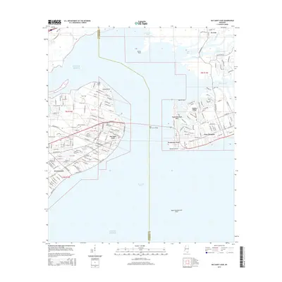
2015 Map of Bay Saint Louis
USGS Topo · Published 2015About this map
The coastal communities of Bay Saint Louis and Waveland are detailed here along the shores of the Mississippi Sound. The map reveals a highly structured landscape of residential tracts and neighborhoods, including Pass Christian, which is connected to the western shore via the prominent Bay Saint Louis Bridge. This span bridges the gap between Hancock and Harrison counties, linking the dense street grids of the mainland to the finger-like peninsulas of Pass Christian Isles and the heights of Timber Ridge.
Find a feature on this map
38 named features on this map. Tap any name to fly to it.
Don’t see what you’re looking for? This feature index may not catch every label — zoom into the map to look around manually.
Map Details
Editions of this 2015 Bay Saint Louis Map
This is the sole edition of this map. No revisions or reprints were ever made.
Other maps of this area

1893 · Cat Island
USGS Topo · 1:62,500

1893 · Toulme
USGS Topo · 1:62,500

1935 · Grand Island Pass
USGS Topo · 1:31,680

1946 · Isle Au Pitre
USGS Topo · 1:31,680

1949 · Grand Island Pass
USGS Topo · 1:31,680

1953 · Mobile
USGS Topo · 1:250,000

1954 · Isle Au Pitre
USGS Topo · 1:31,680

1955 · Pass Christian
USGS Topo · 1:24,000
1955 · Isle Au Pitre
USGS Topo · 1:24,000

1956 · Bay St. Louis
USGS Topo · 1:24,000