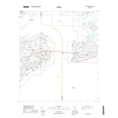
2018 Map of Bay Saint Louis
USGS Topo · Published 2018About this map
Saint Louis Bay serves as the central focal point of this coastal survey, separating the western shoreline communities from the peninsula to the east. The city of Bay St. Louis and neighboring Waveland show a dense grid of residential streets and various land tracts, including Tract 44 and Tract 43. Along the waterfront, historic institutions like Saint Stanislaus College and the Garden of Memory Cem are visible, while the Bay Saint Louis Bridge provides the primary transit link across the water. To the east, the development of Henderson Point and Pass Christian is well-defined, framed by Mallini Bayou and the Mississippi Sound. This 21st-century record captures the complex interface of the Gulf Coast shoreline, where river systems like the Wolf River and Bayou Portage meet the tidal marshes of Grassy Point and Little Bay.
Find a feature on this map
182 named features on this map. Tap any name to fly to it.
Don’t see what you’re looking for? This feature index may not catch every label — zoom into the map to look around manually.
Map Details
Editions of this 2018 Bay Saint Louis Map
This is the sole edition of this map. No revisions or reprints were ever made.
Other maps of this area

1893 · Cat Island
USGS Topo · 1:62,500

1893 · Toulme
USGS Topo · 1:62,500

1935 · Grand Island Pass
USGS Topo · 1:31,680

1946 · Isle Au Pitre
USGS Topo · 1:31,680

1949 · Grand Island Pass
USGS Topo · 1:31,680

1953 · Mobile
USGS Topo · 1:250,000

1954 · Isle Au Pitre
USGS Topo · 1:31,680

1955 · Pass Christian
USGS Topo · 1:24,000
1955 · Isle Au Pitre
USGS Topo · 1:24,000

1956 · Bay St. Louis
USGS Topo · 1:24,000