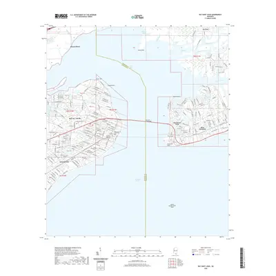
2020 Map of Bay Saint Louis
USGS Topo · Published 2020About this map
Bay St. Louis and Waveland anchor this detailed coastal study, showing the dense grid of the Mississippi Gulf Coast as it appeared in 2020. The map captures the significant infrastructure connecting these communities to Pass Christian, most notably the Bay Saint Louis Bridge spanning Saint Louis Bay. For genealogists and local historians, the sheet identifies key civic and spiritual landmarks, including the Hancock County Courthouse and several significant burial grounds such as Saint Mary Cem and the Brothers of Sacred Heart Cem.
Find a feature on this map
35 named features on this map. Tap any name to fly to it.
Don’t see what you’re looking for? This feature index may not catch every label — zoom into the map to look around manually.
Map Details
Editions of this 2020 Bay Saint Louis Map
This is the sole edition of this map. No revisions or reprints were ever made.
Other maps of this area

1893 · Cat Island
USGS Topo · 1:62,500

1893 · Toulme
USGS Topo · 1:62,500

1935 · Grand Island Pass
USGS Topo · 1:31,680

1946 · Isle Au Pitre
USGS Topo · 1:31,680

1949 · Grand Island Pass
USGS Topo · 1:31,680

1953 · Mobile
USGS Topo · 1:250,000

1954 · Isle Au Pitre
USGS Topo · 1:31,680

1955 · Pass Christian
USGS Topo · 1:24,000
1955 · Isle Au Pitre
USGS Topo · 1:24,000

1956 · Bay St. Louis
USGS Topo · 1:24,000