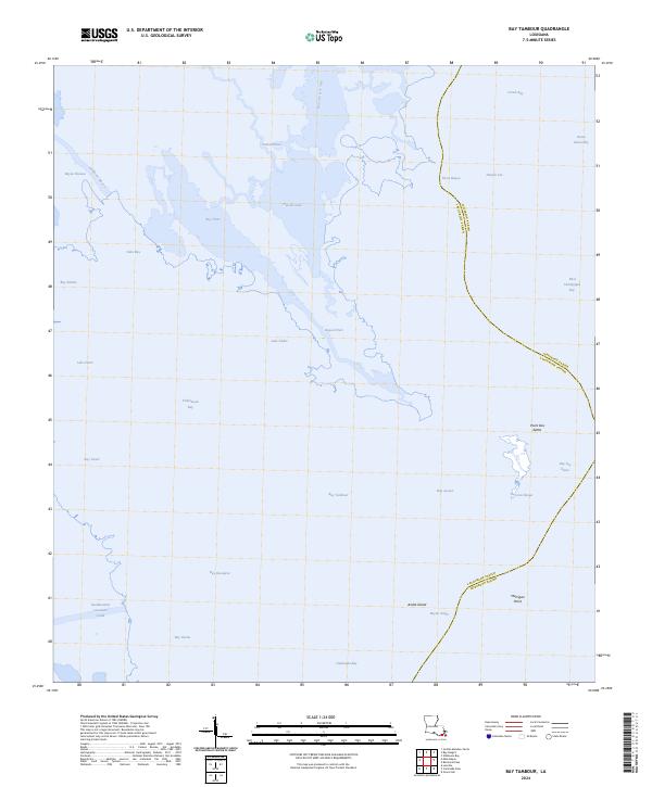
2024 Map of Bay Tambour
USGS Topo · Published 2024About this map
The Southwestern Louisiana Canal cuts through the low-lying marshlands of southern Louisiana, defining a landscape dominated by tidal basins and labyrinthine waterways. This maritime environment is shaped by the transition from open water to interior bayous, featuring large coastal bodies like Caminada Bay and Fishermans Bay. The interior is a complex network of named water features, including Bay Tambour, Hatchet Lake, and Lake Andre, reflecting the fluid geography of the Mississippi Delta region.
Find a feature on this map
36 named features on this map. Tap any name to fly to it.
Don’t see what you’re looking for? This feature index may not catch every label — zoom into the map to look around manually.
Map Details
Editions of this 2024 Bay Tambour Map
This is the sole edition of this map. No revisions or reprints were ever made.
Other maps of this area

1892 · Cheniere Caminada
USGS Topo · 1:62,500

1892 · Creole
USGS Topo · 1:62,500

1893 · Fort Livingston
USGS Topo · 1:62,500

1935 · Mink Bayou
USGS Topo · 1:31,680

1935 · Leeville
USGS Topo · 1:31,680

1935 · Wilkinson Bay
USGS Topo · 1:31,680

1945 · New Orleans
USGS Topo · 1:250,000

1945 · Leeville
USGS Topo · 1:31,680
1946 · Mink Bayou
USGS Topo · 1:31,680

1947 · Caminada Pass
USGS Topo · 1:31,680