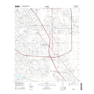
2015 Map of Bayard
USGS Topo · Published 2015About this map
The Saint Johns River defines the western edge of this coastal Florida landscape, where the southern reaches of Jacksonville transition into established residential and academic communities. Significant creek systems, including Julington Creek and Goodbys Creek, carve through the terrain, historically shaping the layout of settlements like Mandarin, Loretto, and Bayard. The map illustrates a modern infrastructure overlaying older community centers, with the Florida Coastal Sch of Law and Remington College-Jacksonville Campus established near major transit corridors like I-95.
Find a feature on this map
36 named features on this map. Tap any name to fly to it.
Don’t see what you’re looking for? This feature index may not catch every label — zoom into the map to look around manually.
Map Details
Editions of this 2015 Bayard Map
This is the sole edition of this map. No revisions or reprints were ever made.
Other maps of this area

1917 · Orange Park
USGS Topo · 1:62,500

1918 · Jacksonville
USGS Topo · 1:62,500

1918 · Orange Park
USGS Topo · 1:62,500

1918 · Palm Valley
USGS Topo · 1:62,500

1918 · Mayport
USGS Topo · 1:62,500

1948 · Jacksonville
USGS Topo · 1:250,000

1948 · Jacksonville Beach
USGS Topo · 1:24,000

1949 · Jacksonville Beach
USGS Topo · 1:24,000

1950 · Arlington
USGS Topo · 1:24,000
1950 · Jacksonville
USGS Topo · 1:24,000
Featured Places
- Jacksonville, FL
- Greenland, Jacksonville
- Wesley Manor Retirement Village, FL
- San Jose, Jacksonville
- Stockade, Jacksonville