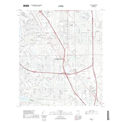
2018 Map of Bayard
USGS Topo · Published 2018About this map
Julington Creek and its southern tributaries define the lower boundary of this Jacksonville landscape, where residential development and institutional expansion met the natural wetlands of the Atlantic coastal plain. The map documents the persistent identity of historical communities like Mandarin, Loretto, and Bayard amidst the modern suburban sprawl. Local history is anchored by sites like the Saint Joseph Cem and the Julington Cem, while higher education is represented by the Florida Coastal School of Law and Remington College-Jacksonville Campus. The intricate drainage network of Sweetwater Creek and the Pottsburg Creek Swamp highlights the environmental constraints that shaped the growth of neighborhoods like Deerwood Club and Greenland. This survey captures the conversion of traditional rural crossroads into a dense network of residential subdivisions and commercial corridors, bridged by structures such as Burnett Bridge over the wetlands.
Find a feature on this map
261 named features on this map. Tap any name to fly to it.
Don’t see what you’re looking for? This feature index may not catch every label — zoom into the map to look around manually.
Map Details
Editions of this 2018 Bayard Map
This is the sole edition of this map. No revisions or reprints were ever made.
Other maps of this area

1917 · Orange Park
USGS Topo · 1:62,500

1918 · Jacksonville
USGS Topo · 1:62,500

1918 · Orange Park
USGS Topo · 1:62,500

1918 · Palm Valley
USGS Topo · 1:62,500

1918 · Mayport
USGS Topo · 1:62,500

1948 · Jacksonville
USGS Topo · 1:250,000

1948 · Jacksonville Beach
USGS Topo · 1:24,000

1949 · Jacksonville Beach
USGS Topo · 1:24,000

1950 · Arlington
USGS Topo · 1:24,000
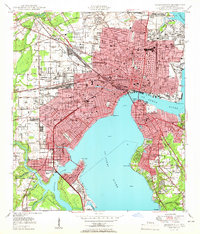
1950 · Jacksonville
USGS Topo · 1:24,000
Featured Places
- Jacksonville, FL
- Greenland, Jacksonville
- Wesley Manor Retirement Village, FL
- San Jose, Jacksonville
- Stockade, Jacksonville