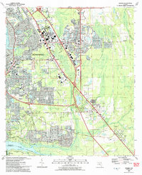
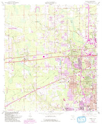
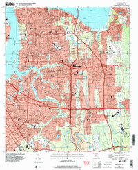
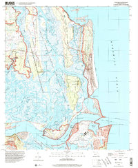
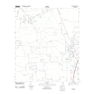
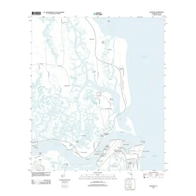
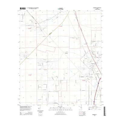
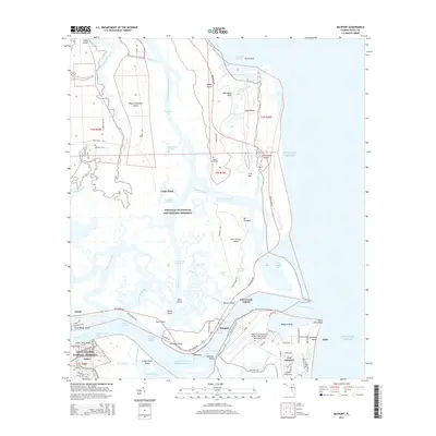
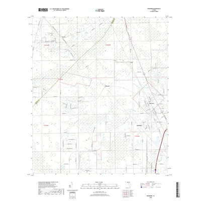
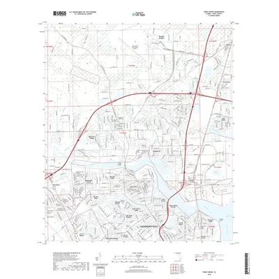
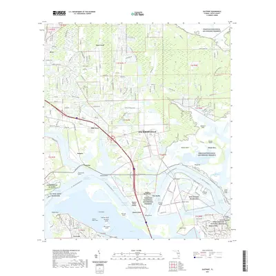
1993 Map of Bayard
USGS Topo · Published 1993About this map
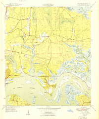
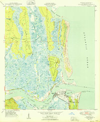
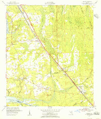
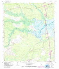
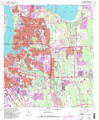
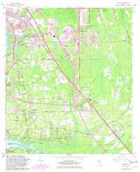
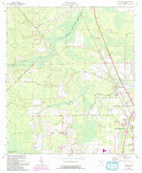
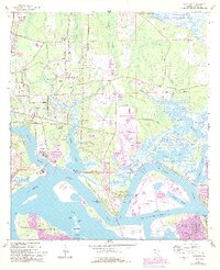
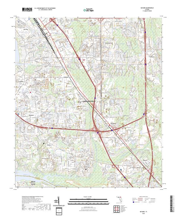
Loretto and Mandarin anchor the western portion of this landscape, reflecting a period of significant suburban expansion southeast of the Jacksonville city center. The 1993 edition highlights a dense network of spiritual and educational institutions that served these growing communities, including the St Joseph Ch, First Baptist Ch, and Loretto Sch. Near the southern border, the Duval Co St Johns Co line intersects the winding course of Julington Creek, where the Wesley Manor Retirement Village sits near the waterfront. To the east, the settlement of Bayard remains a distinct point along the rail and road corridors, characterized by local landmarks like the Julington Cem and New Allen Chapel. The map reveals the transformation of Florida's flatwoods into residential developments, while still preserving large swampy tracts like Gum Swamp and the natural drainages of Pottsburg Creek and Sweetwater Creek.
Find a feature on this map
55 named features on this map. Tap any name to fly to it.
Don’t see what you’re looking for? This feature index may not catch every label — zoom into the map to look around manually.
Map Details
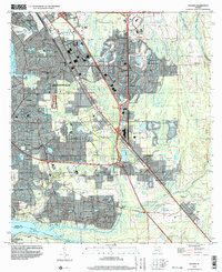
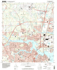
Editions of this 1993 Bayard Map
2 editions found
Historical Maps of Jacksonville Through Time
64 maps found
1917 Cambon
Duval County, FL
1918 Cambon
Duval County, FL

1918 Mayport
Duval County, FL

1948 Eastport
Duval County, FL
1950 Arlington
Duval County, FL
1950 Eastport
Duval County, FL
1950 Mayport
Duval County, FL

1950 Trout River
Duval County, FL
1952 Bayard
Duval County, FL
1958 Italia
Duval County, FL
1963 Arlington
Duval County, FL
1964 Bayard
Duval County, FL
1964 Dinsmore
Duval County, FL
1964 Eastport
Duval County, FL
1964 Marietta
Duval County, FL
1964 Mayport
Duval County, FL
1964 Trout River
Duval County, FL
1993 Bayard
Duval County, FL
1994 Arlington
Duval County, FL
1994 Bayard
Duval County, FL
1994 Eastport
Duval County, FL
1994 Marietta
Duval County, FL
1994 Mayport
Duval County, FL
1994 Trout River
Duval County, FL
2012 Arlington
Duval County, FL
2012 Bayard
Duval County, FL
2012 Dinsmore
Duval County, FL
2012 Eastport
Duval County, FL
2012 Italia
Duval County, FL
2012 Marietta
Duval County, FL
2012 Mayport
Duval County, FL
2012 Trout River
Duval County, FL
2015 Arlington
Duval County, FL
2015 Bayard
Duval County, FL
2015 Dinsmore
Duval County, FL
2015 Eastport
Duval County, FL
2015 Italia
Duval County, FL
2015 Marietta
Duval County, FL
2015 Mayport
Duval County, FL
2015 Trout River
Duval County, FL
2018 Arlington
Duval County, FL
2018 Bayard
Duval County, FL
2018 Dinsmore
Duval County, FL

2018 Eastport
Duval County, FL
2018 Italia
Duval County, FL
2018 Marietta
Duval County, FL
2018 Mayport
Duval County, FL
2018 Trout River
Duval County, FL
2021 Arlington
Duval County, FL
2021 Bayard
Duval County, FL
2021 Dinsmore
Duval County, FL
2021 Eastport
Duval County, FL
2021 Italia
Duval County, FL
2021 Marietta
Duval County, FL
2021 Mayport
Duval County, FL
2021 Trout River
Duval County, FL
2024 Arlington
Duval County, FL
2024 Bayard
Duval County, FL
2024 Dinsmore
Duval County, FL
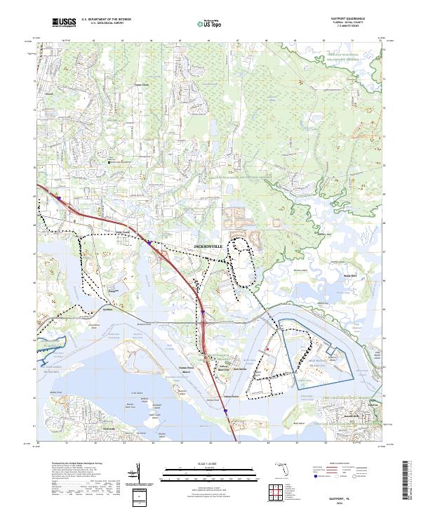
2024 Eastport
Duval County, FL
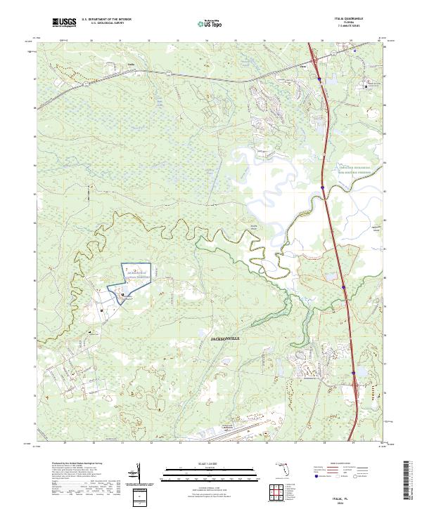
2024 Italia
Duval County, FL
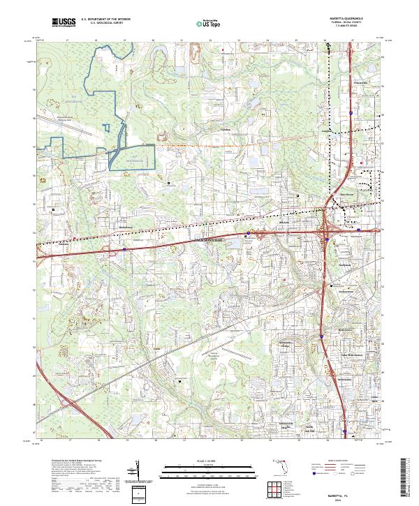
2024 Marietta
Duval County, FL
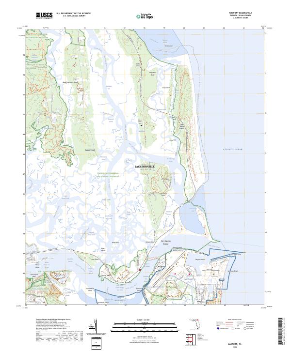
2024 Mayport
Duval County, FL
2024 Trout River
Duval County, FL
Featured Locations
- Jacksonville, FL
- Greenland, Jacksonville
- San Jose, Jacksonville
- Stockade, Jacksonville
- Bayard, Jacksonville