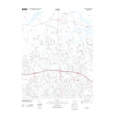
2013 Map of Bayleaf
USGS Topo · Published 2013About this map
Bayleaf and Leesville anchor this northern Wake County landscape as it transitioned into the modern suburban era. The map reveals a high density of residential development intertwined with older geographic markers, such as the prominent Adam Mountain and the significant drainage basins of Upper Barton Cr and Lower Barton Cr. A distinct pattern of water management is visible through numerous impoundments, including Brinkley Lake, Mitchell Pond, and Hammonds Pond, which dot the terrain alongside winding modern street networks like Black Horse Run. The confluence of traditional crossroads at Six Forks and the presence of regional arteries like Bus 70 demonstrate how historical travel routes became the foundation for contemporary transit. Local historians can trace the persistence of older rural roads like Boyce Mill Rd and Union Grove Rd as they weave through the rapidly densifying neighborhoods of the early 21st century.
Find a feature on this map
366 named features on this map. Tap any name to fly to it.
Don’t see what you’re looking for? This feature index may not catch every label — zoom into the map to look around manually.
Map Details
Editions of this 2013 Bayleaf Map
This is the sole edition of this map. No revisions or reprints were ever made.
Other maps of this area

1943 · Durham South
USGS Topo · 1:62,500

1943 · Raleigh
USGS Topo · 1:62,500

1943 · Creedmoor
USGS Topo · 1:62,500

1944 · Creedmoor
USGS Topo · 1:62,500

1951 · Raleigh
USGS Topo · 1:62,500

1951 · Durham South
USGS Topo · 1:62,500

1951 · Durham North
USGS Topo · 1:62,500

1953 · Raleigh
USGS Topo · 1:250,000

1953 · Greensboro
USGS Topo · 1:250,000

1954 · Greensboro
USGS Topo · 1:250,000