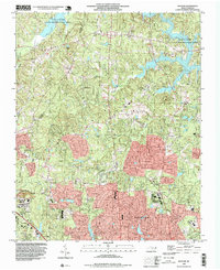
1993 Map of Bayleaf
USGS Topo · Published 1999About this map
Falls Lake and the Falls Lake State Recreation Area dominate the northern terrain of this Wake County landscape, reflecting the significant hydrological changes in the Neuse River basin. To the south, the expansion of Raleigh is evident, with the Raleigh Corp Bdy pushing toward established communities like Leesville and Six Forks. The map documents a transition from rural crossroads to suburban development, anchored by a network of local congregations including Union Grove Ch, Wake Minister Ch, and New Bethel Ch.
Find a feature on this map
26 named features on this map. Tap any name to fly to it.
Don’t see what you’re looking for? This feature index may not catch every label — zoom into the map to look around manually.
Map Details
Editions of this 1993 Bayleaf Map
This is the sole edition of this map. No revisions or reprints were ever made.
Other maps of this area

1943 · Durham South
USGS Topo · 1:62,500

1943 · Raleigh
USGS Topo · 1:62,500

1943 · Creedmoor
USGS Topo · 1:62,500

1944 · Creedmoor
USGS Topo · 1:62,500

1951 · Raleigh
USGS Topo · 1:62,500

1951 · Durham South
USGS Topo · 1:62,500

1951 · Durham North
USGS Topo · 1:62,500

1953 · Raleigh
USGS Topo · 1:250,000

1953 · Greensboro
USGS Topo · 1:250,000

1954 · Greensboro
USGS Topo · 1:250,000