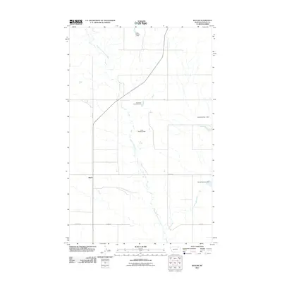
2011 Map of Baylor
USGS Topo · Published 2011About this map
Middle Fork Porcupine Creek meanders through this agricultural landscape in Valley County, reflecting the critical importance of water management in northeastern Montana. This 2011 survey illustrates a network of specialized earthen structures, including the Eddie Number 1 Dam, Eddie Number 2 Dam, and Long Horn Number 4 Dam, which suggest a heritage of ranching and irrigation in the Baylor area. The road network, featuring Asleson Rd and Ruffcorn Rd, provides a framework for the rural homesteads and family holdings that define the region. To the east, Bog Creek and the Neufeld Number 2 Dam further emphasize the systematic capture of seasonal runoff in this high plains environment.
Find a feature on this map
14 named features on this map. Tap any name to fly to it.
Don’t see what you’re looking for? This feature index may not catch every label — zoom into the map to look around manually.
Map Details
Editions of this 2011 Baylor Map
This is the sole edition of this map. No revisions or reprints were ever made.
Other maps of this area

1919 · Boundary
USGS Topo · 1:125,000

1954 · Glasgow
USGS Topo · 1:250,000

1957 · Glasgow
USGS Topo · 1:250,000

1958 · Glasgow
USGS Topo · 1:250,000

1973 · Baylor SE
USGS Topo · 1:24,000

1973 · Glentana West
USGS Topo · 1:24,000

1973 · Baylor NE
USGS Topo · 1:24,000

1973 · Baylor
USGS Topo · 1:24,000

1973 · Opheim
USGS Topo · 1:24,000

1973 · Cameron Point
USGS Topo · 1:24,000