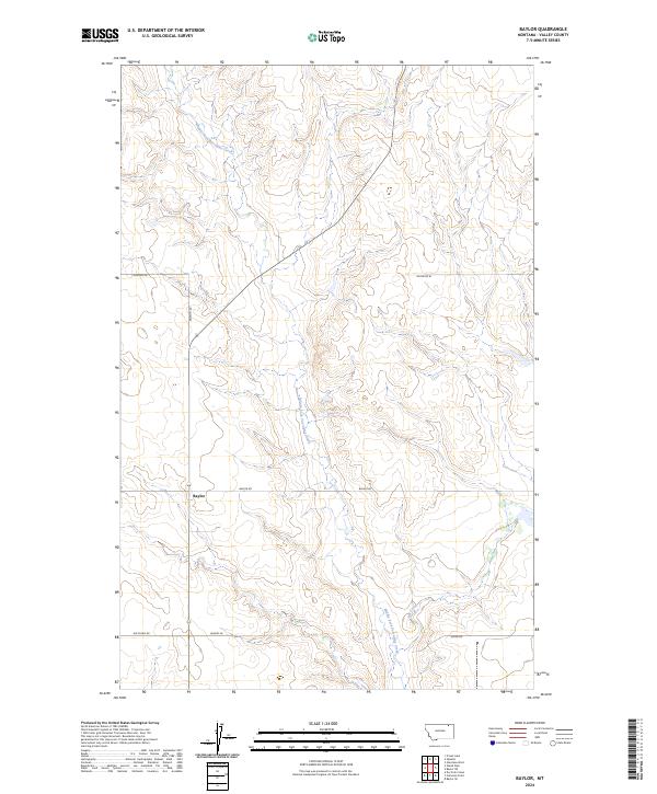
2024 Map of Baylor
USGS Topo · Published 2024About this map
Baylor serves as the focal point of this rural Valley County landscape, situated at the junction of Baylor Rd and Asleson Rd. This 2024 survey depicts a high-plains terrain defined by the winding course of the Middle Fork Porcupine Creek, which serpentines from the northwest toward the southeast across the central quadrangle. The drainage pattern is further detailed by the presence of Bog Creek in the eastern reaches.
Find a feature on this map
16 named features on this map. Tap any name to fly to it.
Don’t see what you’re looking for? This feature index may not catch every label — zoom into the map to look around manually.
Map Details
Editions of this 2024 Baylor Map
This is the sole edition of this map. No revisions or reprints were ever made.
Other maps of this area

1919 · Boundary
USGS Topo · 1:125,000

1954 · Glasgow
USGS Topo · 1:250,000

1957 · Glasgow
USGS Topo · 1:250,000

1958 · Glasgow
USGS Topo · 1:250,000

1973 · Baylor SE
USGS Topo · 1:24,000

1973 · Glentana West
USGS Topo · 1:24,000

1973 · Baylor NE
USGS Topo · 1:24,000

1973 · Baylor
USGS Topo · 1:24,000

1973 · Opheim
USGS Topo · 1:24,000

1973 · Cameron Point
USGS Topo · 1:24,000