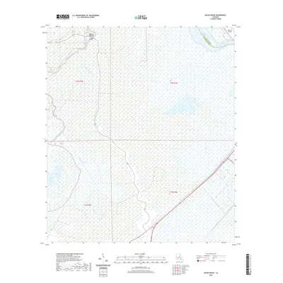
2020 Map of Bayou Boeuf
USGS Topo · Published 2020About this map
Bayou Boeuf sits at the northern edge of this hydrologic study, a small settlement defined by its relationship to the surrounding marshlands and waterways. The community is linked to the broader parish by the Kraemer Bridge, which spans the waterway near the junction of several drainage features. The landscape is dominated by a complex network of freshwater wetlands and engineered waterways, including the Bowie Canal and Godchaux Canal, which reflect decades of water management and agricultural drainage efforts in the low-lying terrain between the Lafourche and St. Charles Parish lines.
Find a feature on this map
15 named features on this map. Tap any name to fly to it.
Don’t see what you’re looking for? This feature index may not catch every label — zoom into the map to look around manually.
Map Details
Editions of this 2020 Bayou Boeuf Map
This is the sole edition of this map. No revisions or reprints were ever made.
Other maps of this area

1891 · Hahnville
USGS Topo · 1:62,500

1892 · Lac Des Allemands
USGS Topo · 1:62,500

1892 · Cut-Off
USGS Topo · 1:62,500

1892 · Houma
USGS Topo · 1:62,500

1932 · Lac Des Allemands NW
USGS Topo · 1:31,680

1932 · Lac Des Allemands SE
USGS Topo · 1:31,680

1932 · Lac Des Allemands SW
USGS Topo · 1:31,680

1932 · Houma NE
USGS Topo · 1:31,680

1932 · Houma NW
USGS Topo · 1:31,680

1932 · Hahnville NW
USGS Topo · 1:31,680