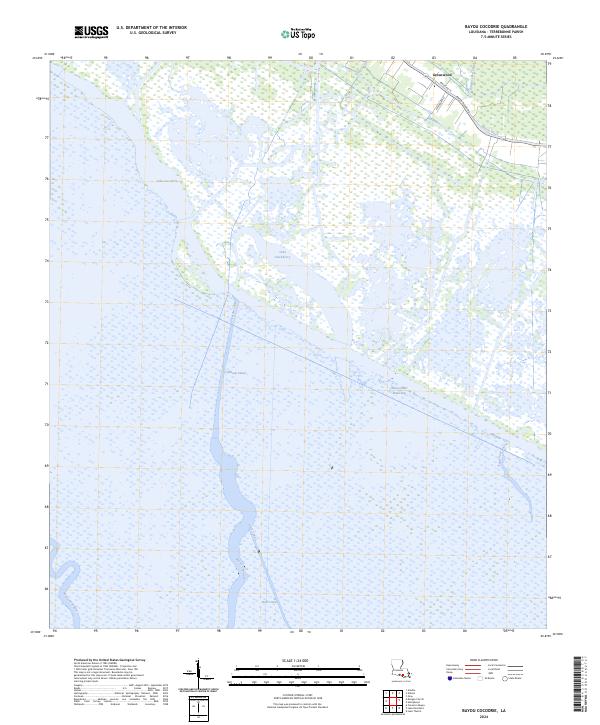
2024 Map of Bayou Cocodrie
USGS Topo · Published 2024About this map
Greenwood sits at the northeastern edge of this Terrebonne Parish landscape, where the terrestrial road network of Parish Rd 15 and Bayou Black Dr meets an intricate world of marsh and cypress swamp. The map is dominated by the vast, open waters of Lake Cocodrie and Lake Hackberry, connected by a sophisticated system of engineered channels including the Copasaw Canal and Huth Canal. These waterways represent the essential infrastructure of the Louisiana wetlands, facilitating transport and drainage across a terrain where water is the primary thoroughfare.
Find a feature on this map
20 named features on this map. Tap any name to fly to it.
Don’t see what you’re looking for? This feature index may not catch every label — zoom into the map to look around manually.
Map Details
Editions of this 2024 Bayou Cocodrie Map
This is the sole edition of this map. No revisions or reprints were ever made.
Other maps of this area

1892 · Gibson
USGS Topo · 1:62,500

1894 · Bayou De Large
USGS Topo · 1:62,500

1897 · Gibson
USGS Topo · 1:62,500

1932 · Lake Decade
USGS Topo · 1:62,500

1935 · Theriot
USGS Topo · 1:31,680

1935 · Morgan City
USGS Topo · 1:62,500

1935 · Lake Penchant
USGS Topo · 1:31,680

1939 · Gibson
USGS Topo · 1:62,500

1940 · Bayou Du Large
USGS Topo · 1:62,500

1941 · Bayou Du Large
USGS Topo · 1:62,500