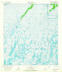
1964 Map of Bayou Sauveur
USGS Topo · Published 1965About this map
Bayou Du Large snakes through the marshy expanse of Terrebonne Parish, serving as the primary corridor for settlement and industry in this coastal landscape. The narrow ribbon of firm ground along the bayou banks supports a string of structures, including the Bayou Du Large Ch, Immaculate Conception Ch, and St Andrews Ch, illustrating the importance of waterborne access for community life. Away from the central bayou, the terrain dissolves into a complex network of wetlands and open water like Moncleuse Bay and Bayou Sauveur. The mid-1960s industrial presence is clearly marked by the Bayou Rambio Oil and Gas Field and the Four Isle Oil and Gas Field, with numerous canals and a Radio Tower punctuating the low-lying reaches. This map documents the intersection of traditional bayou life and the mid-century expansion of the energy sector in Southern Louisiana.
Find a feature on this map
27 named features on this map. Tap any name to fly to it.
Don’t see what you’re looking for? This feature index may not catch every label — zoom into the map to look around manually.
Map Details
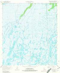
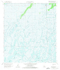
Editions of this 1964 Bayou Sauveur Map
3 editions found
Other maps of this area

1894 · Bayou De Large
USGS Topo · 1:62,500

1894 · Dulac
USGS Topo · 1:62,500

1935 · Cocodrie
USGS Topo · 1:31,680

1935 · Theriot
USGS Topo · 1:31,680

1935 · Lake Mechant
USGS Topo · 1:31,680

1935 · Lake Quitman
USGS Topo · 1:31,680

1935 · Lake Gero
USGS Topo · 1:31,680

1935 · Lake Penchant
USGS Topo · 1:31,680

1940 · Bayou Du Large
USGS Topo · 1:62,500

1941 · Bayou Du Large
USGS Topo · 1:62,500