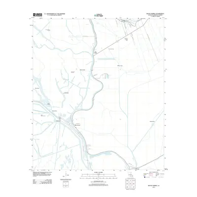
2012 Map of Bayou Sorrel
USGS Topo · Published 2012About this map
The Lower Grand River and its labyrinthine bayous define this Iberville Parish landscape, where water and industry have long been intertwined. The settlement of Bayou Sorrel sits at a critical junction of the river and local roads, supported by the nearby Bayou Sorrel Boat Landing. The region's archaeological and cultural history is evidenced by the Indian Mound Cem, while its modern economic character is shaped by extensive energy extraction. Numerous designated zones including the Sullivan Lake Oil and Gas Field and Crescent Oil Field are scattered across the wetlands.
Find a feature on this map
50 named features on this map. Tap any name to fly to it.
Don’t see what you’re looking for? This feature index may not catch every label — zoom into the map to look around manually.
Map Details
Editions of this 2012 Bayou Sorrel Map
This is the sole edition of this map. No revisions or reprints were ever made.
Other maps of this area

1908 · Baton Rouge
USGS Topo · 1:62,500

1935 · Chicot Lake
USGS Topo · 1:62,500

1936 · White Castle
USGS Topo · 1:62,500

1939 · Baton Rouge
USGS Topo · 1:62,500

1940 · Grosse Tete
USGS Topo · 1:62,500

1953 · Crescent
USGS Topo · 1:24,000

1953 · Plaquemine
USGS Topo · 1:24,000

1953 · Pigeon Bay
USGS Topo · 1:24,000

1953 · Addis
USGS Topo · 1:24,000

1953 · Grosse Tete SW
USGS Topo · 1:24,000