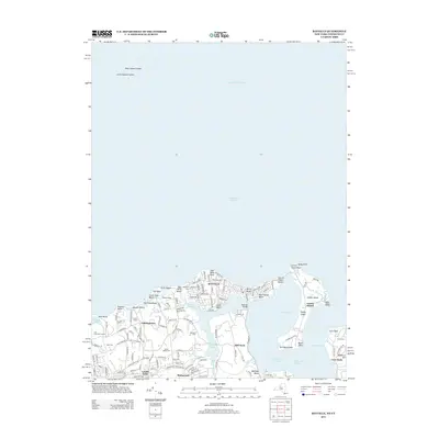
2013 Map of Bayville
USGS Topo · Published 2013About this map
Oyster Bay Harbor and Long Island Sound define this coastal landscape, where the narrow peninsula of Bayville stretches between the sound and West Harbor. The residential and estate character of the North Shore is evident through named properties like the Gebbs Estate and Guther Estate, alongside established village centers in Lattingtown and Locust Valley. A complex network of bays, inlets, and points dominates the geography, linked by the Bayville Bridge crossing to the mainland. Genealogists and local historians will find significant value in the distribution of family-named burial sites, including Pratt Cem, Underhill Cem, and Smith Cem. From the landmarks of Sagamore Hill to the recreation areas at Glen Cove Golf Course and The Creek Beach, the map captures a mature landscape of coastal New York as it appeared in the early 21st century.
Find a feature on this map
131 named features on this map. Tap any name to fly to it.
Don’t see what you’re looking for? This feature index may not catch every label — zoom into the map to look around manually.
Map Details
Editions of this 2013 Bayville Map
This is the sole edition of this map. No revisions or reprints were ever made.
Other maps of this area

1892 · Stamford
USGS Topo · 1:62,500

1892 · Norwalk
USGS Topo · 1:62,500

1893 · Stamford
USGS Topo · 1:62,500

1893 · Norwalk
USGS Topo · 1:62,500

1897 · Oyster Bay
USGS Topo · 1:62,500

1898 · Oyster Bay
USGS Topo · 1:62,500

1899 · Stamford
USGS Topo · 1:62,500

1900 · Oyster Bay
USGS Topo · 1:62,500

1901 · Northport
USGS Topo · 1:62,500

1903 · Northport
USGS Topo · 1:62,500