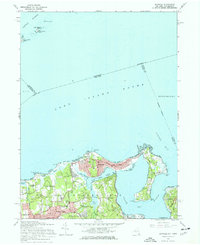
1967 Map of Bayville
USGS Topo · Published 1968About this map
Oak Neck and the narrow beaches of the North Shore define this coastal survey, where the barrier-like peninsula of Bayville separates Long Island Sound from the sheltered waters of Oyster Bay and Mill Neck Creek. The landscape reflects a mix of prestigious estates and local history, anchored by the Sagamore Hill Nat Historical Site near Cove Neck. This period of the late 1960s captures the area's established character, showing significant landmarks like the St Josephs Monastery and Mill Neck Manor Sch. Inland, the villages of Locust Valley, Lattingtown, and Matinecock are marked by large parcels and winding roads such as Lattingtown Rd. To the north, the offshore islands of Captain Harbor, including Great Captain Island and Wee Captain Island, are carefully charted alongside sandbars and reefs like Centre Island Reef.
Find a feature on this map
55 named features on this map. Tap any name to fly to it.
Don’t see what you’re looking for? This feature index may not catch every label — zoom into the map to look around manually.
Map Details
Editions of this 1967 Bayville Map
Other maps of this area

1892 · Stamford
USGS Topo · 1:62,500

1892 · Norwalk
USGS Topo · 1:62,500

1893 · Stamford
USGS Topo · 1:62,500

1893 · Norwalk
USGS Topo · 1:62,500

1897 · Oyster Bay
USGS Topo · 1:62,500

1898 · Oyster Bay
USGS Topo · 1:62,500

1899 · Stamford
USGS Topo · 1:62,500

1900 · Oyster Bay
USGS Topo · 1:62,500

1901 · Northport
USGS Topo · 1:62,500

1903 · Northport
USGS Topo · 1:62,500