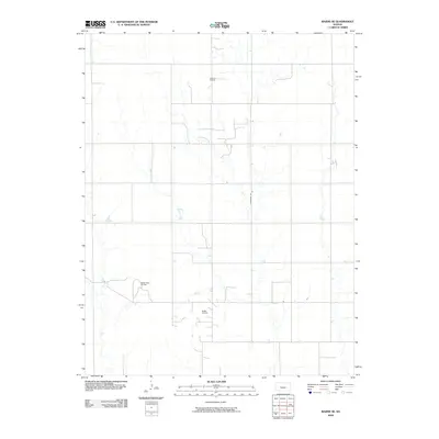
2009 Map of Bazine SE
USGS Topo · Published 2009About this map
Schadel Oil Field and the Steffen Oil Field systems define the industrial footprint of this portion of Pawnee County in the early twenty-first century. The landscape is marked by a strict section-line grid of roads and tracks, with Alexander Rd serving as a primary north-south artery through the territory. This map documents the persistent role of energy extraction in the rural Kansas economy, showing the precise distribution of infrastructure within the Steffen West Oil Field and its neighboring developments. The drainage patterns and subtle elevation changes across the plains are meticulously charted, providing a baseline for environmental and geological study in a region where the subsurface economy heavily influences the surface landscape.
Find a feature on this map
4 named features on this map. Tap any name to fly to it.
Don’t see what you’re looking for? This feature index may not catch every label — zoom into the map to look around manually.
Map Details
Editions of this 2009 Bazine SE Map
This is the sole edition of this map. No revisions or reprints were ever made.
Other maps of this area

1889 · Larned
USGS Topo · 1:125,000

1891 · Larned
USGS Topo · 1:125,000

1892 · Ness
USGS Topo · 1:125,000

1894 · Ness
USGS Topo · 1:125,000

1955 · Great Bend
USGS Topo · 1:250,000

1957 · Great Bend
USGS Topo · 1:250,000

1958 · Great Bend
USGS Topo · 1:250,000

1966 · Alexander
USGS Topo · 1:24,000

1966 · Nekoma
USGS Topo · 1:24,000
1966 · Bazine
USGS Topo · 1:24,000