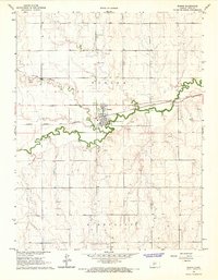
1966 Map of Bazine
USGS Topo · Published 1967About this map
Walnut Creek and Dry Walnut Creek meander through this Western Kansas landscape, dictating the placement of early infrastructure and industry. The town of Bazine is the primary hub, situated along the Atchison Topeka and Santa Fe railroad line. This 1966 field-checked survey reveals an economy deeply tied to the earth's resources, with numerous Quarries and a Sandpit dotting the creek valleys. To the north, the Bazine Cem serves as a significant landmark for genealogists, while the southern reaches of the quadrangle are defined by the development of the Margheim Oil Field and Schaben Oil Field. These oil fields, concentrated near the High Point terrain, indicate the post-war industrial shift in Ness County as petroleum extraction expanded alongside traditional ranching and rail transport.
Find a feature on this map
15 named features on this map. Tap any name to fly to it.
Don’t see what you’re looking for? This feature index may not catch every label — zoom into the map to look around manually.
Map Details
Editions of this 1966 Bazine Map
This is the sole edition of this map. No revisions or reprints were ever made.
Other maps of this area

1892 · Ness
USGS Topo · 1:125,000

1893 · Ellis
USGS Topo · 1:125,000

1894 · Ness
USGS Topo · 1:125,000

1955 · Great Bend
USGS Topo · 1:250,000

1957 · Great Bend
USGS Topo · 1:250,000

1958 · Great Bend
USGS Topo · 1:250,000

1965 · Mc Cracken
USGS Topo · 1:24,000

1966 · Alexander
USGS Topo · 1:24,000

1966 · Ransom SE
USGS Topo · 1:24,000

1966 · Mc Cracken SW
USGS Topo · 1:24,000