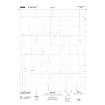
2012 Map of Bazine SE
USGS Topo · Published 2012About this map
Schadel Oil Field and the surrounding prairie of Pawnee County are defined by a rhythmic grid of sectional roads and petroleum development in this 2012 study. The landscape is dominated by the extraction economy of the High Plains, with the Steffen Oil Field and Steffen West Oil Field marking the southern portion of the quadrangle. These named fields imply a history of subsurface rights and family-named mineral leases that have shaped the local land use for decades. Local transport is facilitated by a network of well-maintained county routes, including Co Hwy-524 and Alexander Rd, which bisect the agricultural terrain. The presence of Correction Line Rd serves as a visible reminder of the original Public Land Survey System, where surveyors adjusted for the earth's curvature to maintain the integrity of the township and range grid.
Find a feature on this map
6 named features on this map. Tap any name to fly to it.
Don’t see what you’re looking for? This feature index may not catch every label — zoom into the map to look around manually.
Map Details
Editions of this 2012 Bazine SE Map
This is the sole edition of this map. No revisions or reprints were ever made.
Other maps of this area

1889 · Larned
USGS Topo · 1:125,000

1891 · Larned
USGS Topo · 1:125,000

1892 · Ness
USGS Topo · 1:125,000

1894 · Ness
USGS Topo · 1:125,000

1955 · Great Bend
USGS Topo · 1:250,000

1957 · Great Bend
USGS Topo · 1:250,000

1958 · Great Bend
USGS Topo · 1:250,000

1966 · Alexander
USGS Topo · 1:24,000

1966 · Nekoma
USGS Topo · 1:24,000
1966 · Bazine
USGS Topo · 1:24,000