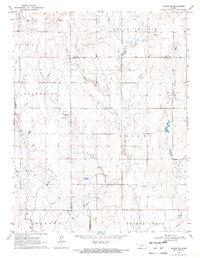
1970 Map of Bazine SE
USGS Topo · Published 1972About this map
Schadel Oil Field and Steffen Oil Field dominate the mid-century landscape of this Central Kansas quadrangle, where the rolling plains are defined by petroleum exploration. The map captures a moment of intensive resource development, marked by numerous Oil Wells, a significant Pipeline cutting through the southern townships, and several scattered Drill Holes. Beyond the industrial footprint, the region's agricultural and civil organization is visible through the borders of Belle Prairie, Marena, and Browns Grove. Local landmarks such as the topographic elevation at High Point and the named area of Shiley provide geographic anchors for researchers. A lone Sandpit in the northwest corner and a Well near the southern boundary further illustrate the practical ways the land was utilized during this era of rural development across Ness and Pawnee Counties.
Find a feature on this map
19 named features on this map. Tap any name to fly to it.
Don’t see what you’re looking for? This feature index may not catch every label — zoom into the map to look around manually.
Map Details
Editions of this 1970 Bazine SE Map
This is the sole edition of this map. No revisions or reprints were ever made.
Other maps of this area

1889 · Larned
USGS Topo · 1:125,000

1891 · Larned
USGS Topo · 1:125,000

1892 · Ness
USGS Topo · 1:125,000

1894 · Ness
USGS Topo · 1:125,000

1955 · Great Bend
USGS Topo · 1:250,000

1957 · Great Bend
USGS Topo · 1:250,000

1958 · Great Bend
USGS Topo · 1:250,000

1966 · Alexander
USGS Topo · 1:24,000

1966 · Nekoma
USGS Topo · 1:24,000
1966 · Bazine
USGS Topo · 1:24,000