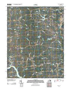
2010 Map of Beach
USGS Topo · Published 2010About this map
Nash Grove and the small settlement of Beach anchor this part of Chesterfield County during a period of significant suburban residential expansion. The landscape is defined by the winding course of Swift Creek and the Appomattox River, where the waters of Lake Chesdin dominate the southwestern corner. Numerous family-named burial grounds, including Mount Gilead Cemetery, Union Branch Cemetery, and Gill Grove Cemetery, are preserved among the newer housing developments and golf courses. The hydraulic history of the region is evident in the several dams and impoundments that punctuate the drainage basins, most notably Crostick Millpond and Lake Margaret. These features illustrate the transformation of Virginia's Piedmont from a rural mill and agricultural economy into a modern residential corridor while still retaining the geographic markers of its earlier generations.
Find a feature on this map
71 named features on this map. Tap any name to fly to it.
Don’t see what you’re looking for? This feature index may not catch every label — zoom into the map to look around manually.
Map Details
Editions of this 2010 Beach Map
This is the sole edition of this map. No revisions or reprints were ever made.
Other maps of this area

1894 · Bermuda Hundred
USGS Topo · 1:62,500

1894 · Petersburg
USGS Topo · 1:62,500

1897 · Amelia
USGS Topo · 1:125,000

1938 · Drewrys Bluff
USGS Topo · 1:24,000

1943 · Chesterfield
USGS Topo · 1:31,680

1943 · Hallsboro
USGS Topo · 1:31,680

1943 · Beach
USGS Topo · 1:24,000

1943 · Church Road
USGS Topo · 1:24,000

1943 · Winterpock
USGS Topo · 1:24,000

1943 · Sutherland
USGS Topo · 1:24,000