
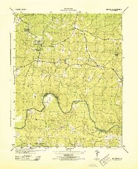
1943 Map of Sutherland
USGS Topo · Published 1961About this map
The Appomattox River carves a winding boundary between Dinwiddie and Chesterfield counties, defining the northern edge of this wartime survey. The landscape is dominated by a transition from forested creeks to the burgeoning transportation corridors that would shape the region’s growth. The Norfolk and Western railway runs east-to-west through the center, serving the settlement of Sutherland, while the Seaboard Air Line cuts through the southeastern corner near Burgess.
Find a feature on this map
53 named features on this map. Tap any name to fly to it.
Don’t see what you’re looking for? This feature index may not catch every label — zoom into the map to look around manually.
Map Details
Editions of this 1943 Sutherland Map
This is the sole edition of this map. No revisions or reprints were ever made.
Other maps of this area

1894 · Bermuda Hundred
USGS Topo · 1:62,500

1894 · Petersburg
USGS Topo · 1:62,500

1897 · Amelia
USGS Topo · 1:125,000

1943 · De Witt
USGS Topo · 1:24,000

1943 · Dinwiddie
USGS Topo · 1:24,000

1943 · Beach
USGS Topo · 1:24,000

1943 · Church Road
USGS Topo · 1:24,000

1943 · Winterpock
USGS Topo · 1:24,000

1943 · Richmond
USGS Topo · 1:250,000
1944 · Winterpock
USGS Topo · 1:31,680