1943 Map of Dinwiddie
USGS Topo · Published 1961About this map
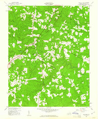
Dinwiddie serves as the focal point of this mid-century survey, shown as a central hub where local life revolved around the Seaboard railroad and foundational institutions like Dinwiddie High Sch. The landscape is characterized by a dense network of small streams and runs, including Stony Creek, Gravelly Run, and Chamberlains Bed Creek, which dictate the placement of rural homesteads and farms.
Find a feature on this map
20 named features on this map. Tap any name to fly to it.
Don’t see what you’re looking for? This feature index may not catch every label — zoom into the map to look around manually.
Map Details
Editions of this 1943 Dinwiddie Map
This is the sole edition of this map. No revisions or reprints were ever made.
Other maps of this area

1894 · Petersburg
USGS Topo · 1:62,500

1897 · Amelia
USGS Topo · 1:125,000

1919 · Jarratt
USGS Topo · 1:62,500

1919 · Mc Kenney
USGS Topo · 1:48,000

1921 · Mc Kenney
USGS Topo · 1:62,500

1943 · Mc Kenney
USGS Topo · 1:62,500

1943 · De Witt
USGS Topo · 1:24,000

1943 · Church Road
USGS Topo · 1:24,000

1943 · Sutherland
USGS Topo · 1:24,000

1943 · Richmond
USGS Topo · 1:250,000