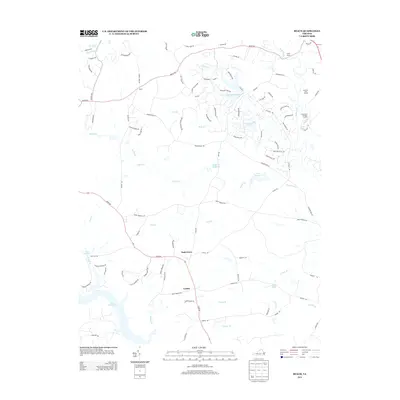
2013 Map of Beach
USGS Topo · Published 2013About this map
Nash Grove and the crossroads of Beach define this area of Chesterfield County, where suburban expansion meets legacy forest and water management. The northern reaches are dominated by the extensive Pocahontas State Frst, a landscape of conservation and recreation that contrasts with the industrial utility of the Southern Area Landfill and Shoosmith Sanitary Landfill to the east. Waterways like Licking Cr and Swift Creek feed into several significant impoundments, including Nash Road Lake, Lake Margaret, and Crostick Millpond. To the southwest, the shoreline of Lake Chesdin serves as a major geographical anchor. The network of winding roads, such as Beach Rd and River Rd, connects these residential settlements with local landmarks like Camp Baker and the small community of Leader.
Find a feature on this map
96 named features on this map. Tap any name to fly to it.
Don’t see what you’re looking for? This feature index may not catch every label — zoom into the map to look around manually.
Map Details
Editions of this 2013 Beach Map
This is the sole edition of this map. No revisions or reprints were ever made.
Other maps of this area

1894 · Bermuda Hundred
USGS Topo · 1:62,500

1894 · Petersburg
USGS Topo · 1:62,500

1897 · Amelia
USGS Topo · 1:125,000

1938 · Drewrys Bluff
USGS Topo · 1:24,000

1943 · Chesterfield
USGS Topo · 1:31,680

1943 · Hallsboro
USGS Topo · 1:31,680

1943 · Beach
USGS Topo · 1:24,000

1943 · Church Road
USGS Topo · 1:24,000

1943 · Winterpock
USGS Topo · 1:24,000

1943 · Sutherland
USGS Topo · 1:24,000