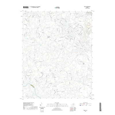
2019 Map of Beach
USGS Topo · Published 2019About this map
Beach and the Chesterfield county seat characterize the residential and administrative landscape of this region south of Richmond. The area is defined by a dense network of suburban development intertwined with older rural foundations, marked by numerous family and congregational burial grounds such as Wilson Cem, Dahl Cem, and the Mount Gilead United Methodist Church Cem. The southern edge of the map is dominated by the expansive Lake Chesdin, formed by the Appomattox River, which marks the boundary between Chesterfield Co and Dinwiddie Co. Inland, the terrain is carved by numerous creek branches including First Br, Second Br, and Third Br, which feed into larger water bodies like Nash Road Lake and the Crosick Millpond. This modern survey reflects the late-20th-century growth of the Richmond periphery, where historic landmarks like the Chesterfield Post Office stand alongside contemporary residential clusters and protected wetlands like Bear Swamp.
Find a feature on this map
129 named features on this map. Tap any name to fly to it.
Don’t see what you’re looking for? This feature index may not catch every label — zoom into the map to look around manually.
Map Details
Editions of this 2019 Beach Map
This is the sole edition of this map. No revisions or reprints were ever made.
Other maps of this area

1894 · Bermuda Hundred
USGS Topo · 1:62,500

1894 · Petersburg
USGS Topo · 1:62,500

1897 · Amelia
USGS Topo · 1:125,000

1938 · Drewrys Bluff
USGS Topo · 1:24,000

1943 · Chesterfield
USGS Topo · 1:31,680

1943 · Hallsboro
USGS Topo · 1:31,680

1943 · Beach
USGS Topo · 1:24,000

1943 · Church Road
USGS Topo · 1:24,000

1943 · Winterpock
USGS Topo · 1:24,000

1943 · Sutherland
USGS Topo · 1:24,000