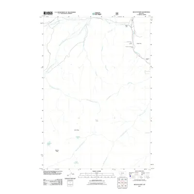
2011 Map of Beacon Point
USGS Topo · Published 2011About this map
Edens Cemetery and the Spanish Creek Ranch sit at the northern edge of this high-elevation landscape, where the Gallatin River flows near the eastern boundary. This 2011 survey documents a topography defined by steep drainage networks, including Little Hell Roaring Creek and Logger Creek, which flow through deep canyons. The southern portion of the map is dominated by prominent alpine features such as Indian Ridge and Beacon Point, surrounded by several isolated water bodies including Grayling Lake, Diamond Lake, and Arrow Lake.
Find a feature on this map
27 named features on this map. Tap any name to fly to it.
Don’t see what you’re looking for? This feature index may not catch every label — zoom into the map to look around manually.
Map Details
Editions of this 2011 Beacon Point Map
This is the sole edition of this map. No revisions or reprints were ever made.
Other maps of this area

1888 · Three Forks
USGS Topo · 1:250,000

1894 · Three Forks
USGS Topo · 1:250,000

1895 · Three Forks
USGS Topo · 1:250,000

1947 · Bozeman
USGS Topo · 1:250,000

1948 · Bozeman
USGS Topo · 1:250,000

1949 · Anceney
USGS Topo · 1:62,500

1950 · Spanish Peaks
USGS Topo · 1:62,500

1953 · Bozeman
USGS Topo · 1:62,500

1955 · Bozeman
USGS Topo · 1:250,000

1955 · Garnet Mountain
USGS Topo · 1:62,500