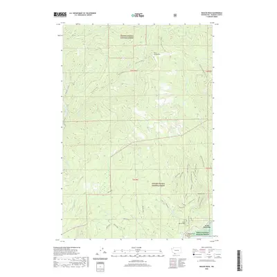
2020 Map of Beacon Rock
USGS Topo · Published 2020About this map
Gifford Pinchot National Forest dominates this mountain landscape in Skamania County, where the southern reaches of the Cascades meet the Columbia River corridor. The map highlights a complex network of recreational and natural landmarks, centered on the towering Hamilton Mountain and the iconic volcanic monolith of Beacon Rock. Modern land management is evident in the transition from the national forest to the Pierce National Wildlife Refuge near the Columbia. The long-distance Pacific Crest National Scenic Trail winds through the northern elevations, passing Three Corners Rock, while more localized paths like the Equestrian Loop and Don's Cut-Off serve visitors closer to the river. Water is a defining element throughout, from the Washougal River in the west to the cascading waters of Hardy Falls and Rodney Falls in the central drainage basins.
Find a feature on this map
43 named features on this map. Tap any name to fly to it.
Don’t see what you’re looking for? This feature index may not catch every label — zoom into the map to look around manually.
Map Details
Editions of this 2020 Beacon Rock Map
This is the sole edition of this map. No revisions or reprints were ever made.
Other maps of this area

1926 · Hood River
USGS Topo · 1:125,000

1929 · Hood River
USGS Topo · 1:125,000

1940 · Lookout Mtn
USGS Topo · 1:62,500

1948 · Vancouver
USGS Topo · 1:250,000

1950 · Vancouver
USGS Topo · 1:250,000

1950 · Vancouver
USGS Topo · 1:250,000

1953 · Lookout Mtn
USGS Topo · 1:62,500

1953 · The Dalles
USGS Topo · 1:250,000

1954 · Bridal Veil
USGS Topo · 1:62,500

1956 · The Dalles
USGS Topo · 1:250,000