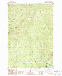
1986 Map of Beacon Rock
USGS Topo · Published 1986About this map
Beacon Rock State Park and the southern edge of the Gifford Pinchot National Forest define this 1980s landscape along the Columbia River. The map illustrates a region transitioning from industrial use to recreational preservation, where a transmission line and a pipeline cross the same terrain as the Pacific Crest National Scenic Trail. Water is the dominant force here, from the massive flow of the Columbia to the smaller Washougal River and Stebbins Creek in the west. Topographical highlights include the iconic Beacon Rock near the riverbank and the high points of Hamilton Mtn and Three Corner Rock. Hikers and land managers can trace routes from the Three Corner Rock Trailhead past the cascading waters of Hardy Falls and Rodney Falls, while industrial footprints like the Barrow Pit and several quarries reflect the ongoing utility of the Skamania County highlands.
Find a feature on this map
29 named features on this map. Tap any name to fly to it.
Don’t see what you’re looking for? This feature index may not catch every label — zoom into the map to look around manually.
Map Details
Editions of this 1986 Beacon Rock Map
2 editions found
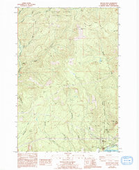
Other maps of this area

1926 · Hood River
USGS Topo · 1:125,000

1929 · Hood River
USGS Topo · 1:125,000

1940 · Lookout Mtn
USGS Topo · 1:62,500

1948 · Vancouver
USGS Topo · 1:250,000

1950 · Vancouver
USGS Topo · 1:250,000

1950 · Vancouver
USGS Topo · 1:250,000

1953 · Lookout Mtn
USGS Topo · 1:62,500

1953 · The Dalles
USGS Topo · 1:250,000

1954 · Bridal Veil
USGS Topo · 1:62,500

1956 · The Dalles
USGS Topo · 1:250,000