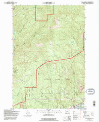
1994 Map of Beacon Rock
USGS Topo · Published 1996About this map
The monolith of Beacon Rock towers above the north bank of the Columbia River, anchoring a landscape of protected lands and dramatic elevation changes. This mid-1990s survey by the U.S. Geological Survey and U.S. Forest Service illustrates a high density of recreation and conservation infrastructure, including the Pacific Crest National Scenic Trail winding through the Gifford Pinchot National Forest. The map details the transition from the Columbia River Gorge National Scenic Area into the high ridges of Three Corner Rock.
Find a feature on this map
36 named features on this map. Tap any name to fly to it.
Don’t see what you’re looking for? This feature index may not catch every label — zoom into the map to look around manually.
Map Details
Editions of this 1994 Beacon Rock Map
This is the sole edition of this map. No revisions or reprints were ever made.
Other maps of this area

1926 · Hood River
USGS Topo · 1:125,000

1929 · Hood River
USGS Topo · 1:125,000

1940 · Lookout Mtn
USGS Topo · 1:62,500

1948 · Vancouver
USGS Topo · 1:250,000

1950 · Vancouver
USGS Topo · 1:250,000

1950 · Vancouver
USGS Topo · 1:250,000

1953 · Lookout Mtn
USGS Topo · 1:62,500

1953 · The Dalles
USGS Topo · 1:250,000

1954 · Bridal Veil
USGS Topo · 1:62,500

1956 · The Dalles
USGS Topo · 1:250,000