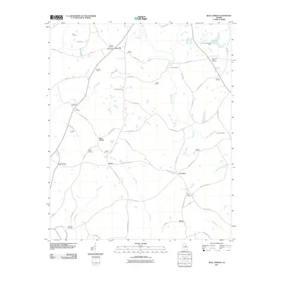
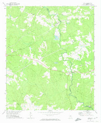
2011 Map of Beall Springs
USGS Topo · Published 2011About this map
Beall Springs and the surrounding rural landscape of Glascock County are defined by a dense network of family-named cemeteries and small creek-side settlements. The drainage patterns of Rocky Comfort Creek and its many tributaries, such as Acy Branch and Joes Creek, historically dictated the placement of homesteads and burial grounds. For genealogists, this 2011 survey is a crucial resource for locating specific family sites, including the Martha Ellen English Cemetery, McCrary Cemetery, and the Pate Cemetery. The map captures a transition from traditional agrarian crossroads like Downs and Blume to a more modern road network, while preserving the identity of historic locales like Stony Hill and Five Points. The presence of several localized dams, such as Johnsons Lake Dam, reflects the local management of water resources in this part of Georgia.
Find a feature on this map
68 named features on this map. Tap any name to fly to it.
Don’t see what you’re looking for? This feature index may not catch every label — zoom into the map to look around manually.
Map Details
Editions of this 2011 Beall Springs Map
This is the sole edition of this map. No revisions or reprints were ever made.
Other maps of this area

1953 · Athens
USGS Topo · 1:250,000

1958 · Athens
USGS Topo · 1:250,000

1959 · Athens
USGS Topo · 1:250,000

1960 · Warthen NE
USGS Topo · 1:24,000

1963 · Athens
USGS Topo · 1:250,000

1971 · Beall Springs
USGS Topo · 1:24,000
1972 · Bastonville
USGS Topo · 1:24,000
1972 · Thomson West
USGS Topo · 1:24,000
1972 · Gibson
USGS Topo · 1:24,000
1972 · Jewell
USGS Topo · 1:24,000