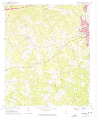
1972 Map of Thomson West
USGS Topo · Published 1974About this map
The city of Thomson serves as the hub of this early 1970s survey, where the concentrated street grid around the Courthouse and City Hall gives way to sprawling institutional and residential developments like Washington Heights. The map documents a period of growth as residential lanes such as Faubus St and Pineview Dr push toward the city limits. Just to the west, the rural landscape of the Warren-McDuffie county line is defined by a series of small, significant community markers.
Find a feature on this map
56 named features on this map. Tap any name to fly to it.
Don’t see what you’re looking for? This feature index may not catch every label — zoom into the map to look around manually.
Map Details
Editions of this 1972 Thomson West Map
2 editions found
Other maps of this area

1892 · Mc Cormick
USGS Topo · 1:125,000

1906 · Crawfordville
USGS Topo · 1:125,000

1912 · Mc Cormick
USGS Topo · 1:125,000

1921 · Appling
USGS Topo · 1:62,500

1922 · Harlem
USGS Topo · 1:62,500

1943 · Appling
USGS Topo · 1:62,500

1948 · Harlem
USGS Topo · 1:62,500

1948 · Thomson East
USGS Topo · 1:24,000

1950 · Dearing
USGS Topo · 1:24,000
1950 · Bowdens Pond
USGS Topo · 1:24,000