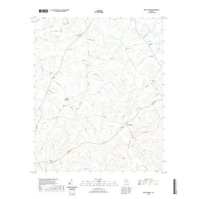
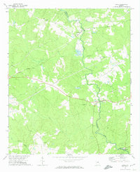
2020 Map of Beall Springs
USGS Topo · Published 2020About this map
Beall Springs and the surrounding rural landscape of eastern Georgia are defined by a complex network of family cemeteries and small creek drainage systems. The terrain is split by the border of Warren and Glascock counties, where the headwaters of Rocky Comfort Cr and its tributaries, including Acy Br and Goldens Cr, carve through the rolling hills. This area is characterized by a high density of ancestral burial grounds such as Martha Ellen English Cem, Beall Baker Cem, and Williams Grove Cem, which suggest a long-standing pattern of dispersed family-owned farmsteads rather than centralized urban development.
Find a feature on this map
76 named features on this map. Tap any name to fly to it.
Don’t see what you’re looking for? This feature index may not catch every label — zoom into the map to look around manually.
Map Details
Editions of this 2020 Beall Springs Map
This is the sole edition of this map. No revisions or reprints were ever made.
Other maps of this area

1953 · Athens
USGS Topo · 1:250,000

1958 · Athens
USGS Topo · 1:250,000

1959 · Athens
USGS Topo · 1:250,000

1960 · Warthen NE
USGS Topo · 1:24,000

1963 · Athens
USGS Topo · 1:250,000

1971 · Beall Springs
USGS Topo · 1:24,000
1972 · Bastonville
USGS Topo · 1:24,000
1972 · Thomson West
USGS Topo · 1:24,000
1972 · Gibson
USGS Topo · 1:24,000
1972 · Jewell
USGS Topo · 1:24,000