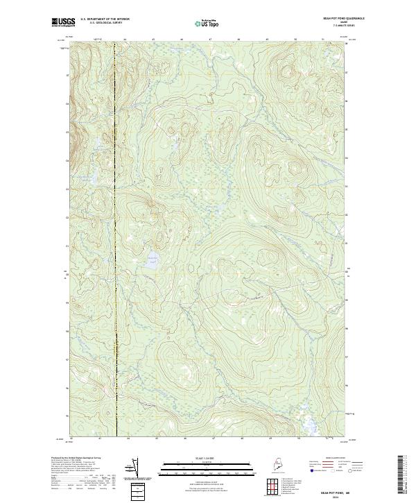
2024 Map of Bean Pot Pond
USGS Topo · Published 2024About this map
The wild hydrologic network of north-central Maine is meticulously documented here, where the boundary between Somerset and Piscataquis counties cuts through a landscape of remote timberlands and interconnected waterways. The central feature, Bean Pot Pond, is situated among a complex of drainage systems including Withey Brook and the expansive Withey Bog, reflecting the low-lying, water-rich character of this glacial terrain. Movement through this region is defined by primitive logging corridors such as Scott Brook Rd and Boulett Camp Rd, which provide the only land-based access to landmarks like Big Mucalsea Pond and the headwaters of Loon Stream. This survey serves as a vital record for understanding the modern footprint of the Maine North Woods, showing how historic stream names like Russell Stream and Smith Brook continue to define the geography of the working forest.
Find a feature on this map
19 named features on this map. Tap any name to fly to it.
Don’t see what you’re looking for? This feature index may not catch every label — zoom into the map to look around manually.
Map Details
Editions of this 2024 Bean Pot Pond Map
This is the sole edition of this map. No revisions or reprints were ever made.
Other maps of this area

1954 · Seboomook Lake
USGS Topo · 1:62,500

1954 · North East Carry
USGS Topo · 1:62,500

1954 · Caucomgomoc Lake
USGS Topo · 1:62,500

1954 · St. John Pond
USGS Topo · 1:62,500

1954 · Presque Isle
USGS Topo · 1:250,000

1954 · Millinocket
USGS Topo · 1:250,000

1958 · Presque Isle
USGS Topo · 1:250,000

1958 · Millinocket
USGS Topo · 1:250,000

1958 · Caucomgomoc Lake
USGS Topo · 1:62,500

1958 · Saint John Pond
USGS Topo · 1:62,500
Featured Places
- Saint John Township, ME
- Russell Pond Township, ME
- T4 R15 WELS, ME
- Elm Stream Township, ME
- T5 R15 WELS, ME