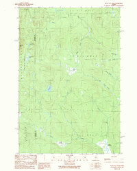
1989 Map of Bean Pot Pond
USGS Topo · Published 1989About this map
Bean Pot Pond and the surrounding wilderness of northwestern Maine are defined by a complex network of wetlands and mountain peaks along the Somerset Co Piscataquis Co line. In this late twentieth-century landscape, the terrain transitions from the heights of Mucalsea Mtn down to the slow-moving waters of Caribou Deadwater and Cassidy Deadwater. These "deadwaters" indicate low-gradient stretches where Russell Stream and Elm Stream meander through the forest, creating vital habitats like Withey Bog.
Find a feature on this map
28 named features on this map. Tap any name to fly to it.
Don’t see what you’re looking for? This feature index may not catch every label — zoom into the map to look around manually.
Map Details
Editions of this 1989 Bean Pot Pond Map
This is the sole edition of this map. No revisions or reprints were ever made.
Other maps of this area

1954 · Seboomook Lake
USGS Topo · 1:62,500

1954 · North East Carry
USGS Topo · 1:62,500

1954 · Caucomgomoc Lake
USGS Topo · 1:62,500

1954 · St. John Pond
USGS Topo · 1:62,500

1954 · Presque Isle
USGS Topo · 1:250,000

1954 · Millinocket
USGS Topo · 1:250,000

1958 · Presque Isle
USGS Topo · 1:250,000

1958 · Millinocket
USGS Topo · 1:250,000

1958 · Caucomgomoc Lake
USGS Topo · 1:62,500

1958 · Saint John Pond
USGS Topo · 1:62,500
Featured Places
- Elm Stream Township, ME
- T4 R15 WELS, ME
- Saint John Township, ME
- Russell Pond Township, ME
- T6 R15 WELS, ME