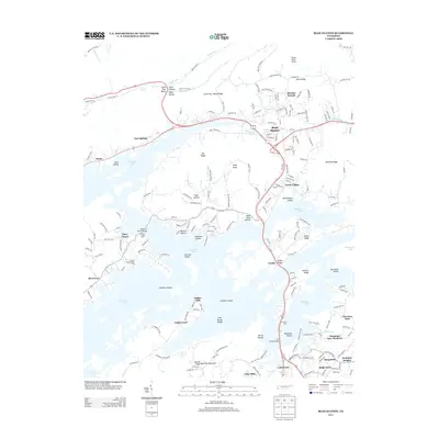
2013 Map of Bean Station
USGS Topo · Published 2013About this map
Bean Station and the sprawling waters of Cherokee Lake dominate this landscape, illustrating the intersection of historic crossroads and mid-century reservoir development. The map shows the significant influence of the Tennessee Valley Authority's engineering on local geography, where former lowlands are now identified as Sheltons Shoals and Coulters Shoals beneath the lake's surface. Transport remains a central theme, with the modern paths of Old Us HWY 25 E and the William P Harrell Bridge crossing the jagged shoreline.
Find a feature on this map
202 named features on this map. Tap any name to fly to it.
Don’t see what you’re looking for? This feature index may not catch every label — zoom into the map to look around manually.
Map Details
Editions of this 2013 Bean Station Map
This is the sole edition of this map. No revisions or reprints were ever made.
Other maps of this area

1883 · Morristown
USGS Topo · 1:125,000

1893 · Morristown
USGS Topo · 1:125,000

1895 · Morristown
USGS Topo · 1:125,000

1935 · Rogersville
USGS Topo · 1:48,000

1935 · Tate Springs
USGS Topo · 1:48,000

1935 · Lee Valley
USGS Topo · 1:24,000

1935 · Springvale
USGS Topo · 1:24,000

1935 · Howard Quarter
USGS Topo · 1:24,000

1935 · Swan Island
USGS Topo · 1:24,000

1935 · Avondale
USGS Topo · 1:24,000