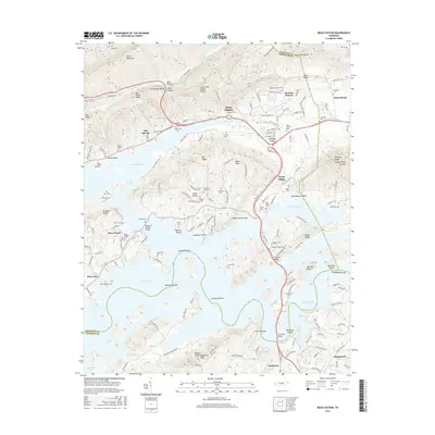
2016 Map of Bean Station
USGS Topo · Published 2016About this map
Cherokee Lake dominates the central landscape of this 2016 survey, where the rising waters have shaped the development of Bean Station and surrounding hamlets. The map documents a complex network of ridges and hollows, including Clinch Mountain and Poor Valley Ridge, that define the local topography. Genealogists will find a wealth of specific local landmarks, such as Bean Station Cem, Marys Chapel Cem, and Harrell Cem, which anchor the history of family settlements like Tate Springs and Wyatt Village. Significant infrastructure, including the William P Harrell Bridge and the D A Green Bridge, provide essential crossings over the expansive reservoir. The mapping of Sheltons Shoals and Coulters Shoals offers insight into the submerged riverbed history that predates the modern lake's shoreline.
Find a feature on this map
144 named features on this map. Tap any name to fly to it.
Don’t see what you’re looking for? This feature index may not catch every label — zoom into the map to look around manually.
Map Details
Editions of this 2016 Bean Station Map
This is the sole edition of this map. No revisions or reprints were ever made.
Other maps of this area

1883 · Morristown
USGS Topo · 1:125,000

1893 · Morristown
USGS Topo · 1:125,000

1895 · Morristown
USGS Topo · 1:125,000

1935 · Rogersville
USGS Topo · 1:48,000

1935 · Tate Springs
USGS Topo · 1:48,000

1935 · Lee Valley
USGS Topo · 1:24,000

1935 · Springvale
USGS Topo · 1:24,000

1935 · Howard Quarter
USGS Topo · 1:24,000

1935 · Swan Island
USGS Topo · 1:24,000

1935 · Avondale
USGS Topo · 1:24,000