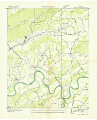
1935 Map of Bean Station
USGS Topo · Published 1935About this map
Tate Springs and the historic crossroads at Bean Station anchor this 1935 survey, which details the valley landscape shortly before the regional impacts of the Tennessee Valley Authority. The Holston River winds through the southern half of the quadrangle, punctuated by Sycamore Island and Payne Island. The mapping reflects a deeply established rural infrastructure of small schools like Lizard Ridge Sch and Kirkham Sch, alongside numerous country churches such as Rock of Ages Ch and Merry Chapel.
Find a feature on this map
69 named features on this map. Tap any name to fly to it.
Don’t see what you’re looking for? This feature index may not catch every label — zoom into the map to look around manually.
Map Details
Editions of this 1935 Bean Station Map
This is the sole edition of this map. No revisions or reprints were ever made.
Other maps of this area

1883 · Morristown
USGS Topo · 1:125,000

1893 · Morristown
USGS Topo · 1:125,000

1895 · Morristown
USGS Topo · 1:125,000

1935 · Rogersville
USGS Topo · 1:48,000

1935 · Tate Springs
USGS Topo · 1:48,000

1935 · Lee Valley
USGS Topo · 1:24,000

1935 · Springvale
USGS Topo · 1:24,000

1935 · Howard Quarter
USGS Topo · 1:24,000

1935 · Swan Island
USGS Topo · 1:24,000

1935 · Avondale
USGS Topo · 1:24,000