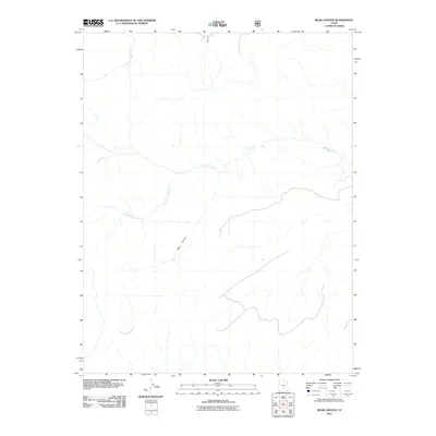
2011 Map of Bear Canyon
USGS Topo · Published 2011About this map
Bear Canyon dominates this 2011 survey, a landscape defined by an intricate network of drainage systems and high-desert watercourses. The drainage patterns here are primarily dictated by Oak Creek and its significant tributary, South Fork Oak Creek, which reveal the deep erosion that has shaped this part of Garfield County over millennia. To the north, Tantalus Creek enters the frame, while Sandy Draw and the Dry Fork carve through the southern and western portions of the quadrangle. This map captures the area just after the first decade of the 21st century, showing a remote terrain where human infrastructure is sparse and the topography is marked almost exclusively by its geological and hydrological features.
Find a feature on this map
6 named features on this map. Tap any name to fly to it.
Don’t see what you’re looking for? This feature index may not catch every label — zoom into the map to look around manually.
Map Details
Editions of this 2011 Bear Canyon Map
This is the sole edition of this map. No revisions or reprints were ever made.
Other maps of this area

1885 · Fish Lake
USGS Topo · 1:250,000

1886 · Escalante
USGS Topo · 1:250,000

1896 · Fish Lake
USGS Topo · 1:250,000

1952 · Notom 4 SE
USGS Topo · 1:24,000

1952 · Notom 4 NW
USGS Topo · 1:24,000

1952 · Notom 4 SW
USGS Topo · 1:24,000

1952 · Notom 4 NE
USGS Topo · 1:24,000

1952 · Notom 3 SE
USGS Topo · 1:24,000

1952 · Notom 3 NE
USGS Topo · 1:24,000

1952 · Grover
USGS Topo · 1:62,500