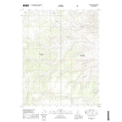
2020 Map of Bear Canyon
USGS Topo · Published 2020About this map
Capitol Reef National Park and Dixie National Forest meet in this high-desert landscape of Garfield County, defined by complex drainages and soaring geological formations. The terrain is characterized by the massive Circle Cliffs to the south and the prominent elevation of Nicks Peak and Oak Creek Point in the north. A network of primitive pathways, including the Oak Creek Trail and S Fork Oak Creek Trail, suggests a long-standing history of movement through these canyons. The presence of The Salmon and Jorgenson Flat provides localized landmarks for navigation in a region where water is a driving force of the topography, seen in the carved paths of North Coleman Canyon, South Coleman Canyon, and Bear Canyon. This survey captures the region's managed wilderness boundary at a time when recreational access and conservation overlap in the Utah backcountry.
Find a feature on this map
26 named features on this map. Tap any name to fly to it.
Don’t see what you’re looking for? This feature index may not catch every label — zoom into the map to look around manually.
Map Details
Editions of this 2020 Bear Canyon Map
This is the sole edition of this map. No revisions or reprints were ever made.
Other maps of this area

1885 · Fish Lake
USGS Topo · 1:250,000

1886 · Escalante
USGS Topo · 1:250,000

1896 · Fish Lake
USGS Topo · 1:250,000

1952 · Notom 4 SE
USGS Topo · 1:24,000

1952 · Notom 4 NW
USGS Topo · 1:24,000

1952 · Notom 4 SW
USGS Topo · 1:24,000

1952 · Notom 4 NE
USGS Topo · 1:24,000

1952 · Notom 3 SE
USGS Topo · 1:24,000

1952 · Notom 3 NE
USGS Topo · 1:24,000

1952 · Grover
USGS Topo · 1:62,500