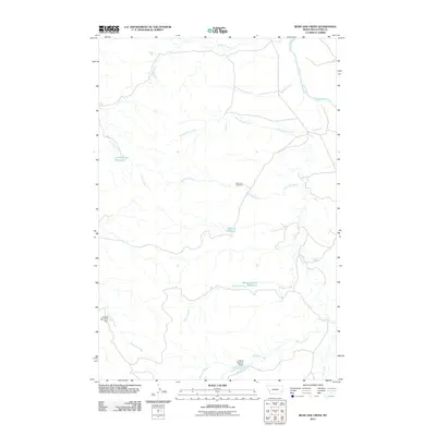
2011 Map of Bear Jaw Creek
USGS Topo · Published 2011About this map
The Powder River carves through this corner of Custer County, defining a landscape shaped by seasonal water management and ranching infrastructure. Numerous drainages such as Kitty Spring Creek and Ash Creek feed into the larger river system, while the presence of the Bear Jaw Windmill and several modest reservoirs highlights the necessity of water collection in this semi-arid environment. The names attached to local features, such as Willie Reservoir, Leidholt Reservoir Dam, and the E Hardy Number 2 Dam, suggest a history of family-owned ranching operations and localized land improvements. Moving south, Morgan Creek Reservoir and the winding Monarch Creek illustrate the complex network of intermittent streams that define the local topography. This document provides a record of land use at the start of the 2010s, showing the specific locations of dams and named water sources critical to the local economy.
Find a feature on this map
15 named features on this map. Tap any name to fly to it.
Don’t see what you’re looking for? This feature index may not catch every label — zoom into the map to look around manually.
Map Details
Editions of this 2011 Bear Jaw Creek Map
This is the sole edition of this map. No revisions or reprints were ever made.
Other maps of this area

1953 · Miles City
USGS Topo · 1:250,000

1954 · Ekalaka
USGS Topo · 1:250,000

1956 · Ekalaka
USGS Topo · 1:250,000

1957 · Miles City
USGS Topo · 1:250,000

1958 · Miles City
USGS Topo · 1:250,000

1958 · Ekalaka
USGS Topo · 1:250,000

1965 · Ekalaka
USGS Topo · 1:250,000

1969 · Mizpah
USGS Topo · 1:24,000

1969 · Forty Creek
USGS Topo · 1:24,000

1969 · Tepee Butte NE
USGS Topo · 1:24,000