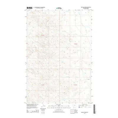
2014 Map of Bear Jaw Creek
USGS Topo · Published 2014About this map
The Powder River cuts across the northeastern corner of this Custer County landscape, defining a sharp contrast between the river bottom and the intricate drainage networks that feed it. The terrain is characterized by a dense system of seasonal watercourses, including Bear Jaw Creek and Ash Creek, which have carved deep patterns into the Montana earth. This 2014 survey documents a ranching landscape where water management is critical, evidenced by the presence of the Willie Reservoir, Corral Creek Reservoir, and Morgan Creek Reservoir. These man-made features are vital anchors in an area where roads are sparse, with Ash Creek Road providing one of the few primary overland routes through the breaks. The map captures the specialized geography of the Big Sky country, from the headwaters of Kitty Spring Creek to the winding path of Monarch Creek.
Find a feature on this map
17 named features on this map. Tap any name to fly to it.
Don’t see what you’re looking for? This feature index may not catch every label — zoom into the map to look around manually.
Map Details
Editions of this 2014 Bear Jaw Creek Map
This is the sole edition of this map. No revisions or reprints were ever made.
Other maps of this area

1953 · Miles City
USGS Topo · 1:250,000

1954 · Ekalaka
USGS Topo · 1:250,000

1956 · Ekalaka
USGS Topo · 1:250,000

1957 · Miles City
USGS Topo · 1:250,000

1958 · Miles City
USGS Topo · 1:250,000

1958 · Ekalaka
USGS Topo · 1:250,000

1965 · Ekalaka
USGS Topo · 1:250,000

1969 · Mizpah
USGS Topo · 1:24,000

1969 · Forty Creek
USGS Topo · 1:24,000

1969 · Tepee Butte NE
USGS Topo · 1:24,000