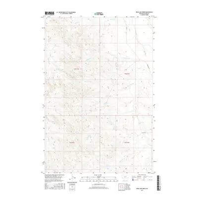
2017 Map of Bear Jaw Creek
USGS Topo · Published 2017About this map
Bear Jaw Creek flows through the center of this drainage basin in eastern Custer County, shaping a landscape defined by seasonal water management and livestock ranching. The topographic record shows several critical catchment points, including Corral Cr Reservoir and Willie Reservoir, which provide essential water resources for this arid region. The eastern boundary is marked by the valley of the Powder River, which remains a vital corridor for travel and ranching access. Numerous smaller drainages such as Kitty Spring Cr and Morgan Cr feed into the primary creek systems, carving deep coulees into the Montana plains. Transportation in this area is limited to a few arterial routes like Powder River Rd and Ash Creek Rd, which link the isolated homesteads and grazing lands to the broader region during the 2010s.
Find a feature on this map
20 named features on this map. Tap any name to fly to it.
Don’t see what you’re looking for? This feature index may not catch every label — zoom into the map to look around manually.
Map Details
Editions of this 2017 Bear Jaw Creek Map
This is the sole edition of this map. No revisions or reprints were ever made.
Other maps of this area

1953 · Miles City
USGS Topo · 1:250,000

1954 · Ekalaka
USGS Topo · 1:250,000

1956 · Ekalaka
USGS Topo · 1:250,000

1957 · Miles City
USGS Topo · 1:250,000

1958 · Miles City
USGS Topo · 1:250,000

1958 · Ekalaka
USGS Topo · 1:250,000

1965 · Ekalaka
USGS Topo · 1:250,000

1969 · Mizpah
USGS Topo · 1:24,000

1969 · Forty Creek
USGS Topo · 1:24,000

1969 · Tepee Butte NE
USGS Topo · 1:24,000