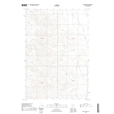
2020 Map of Bear Jaw Creek
USGS Topo · Published 2020About this map
Powder River drainage basins and high prairie terrain dominate this Custer County landscape, characterized by a complex network of seasonal watercourses and man-made impoundments. The area is defined by its drainage systems, including the namesake Bear Jaw Cr and Kitty Spring Cr which carve through the undulating topography. Human modification of the landscape for ranching or agricultural purposes is evident through the placement of Corral Cr Reservoir, Willie Reservoir, and Morgan Cr Reservoir. These features suggest a reliance on managed water resources in this part of Montana. Connectivity is limited to rural routes such as Ash Creek Rd and RD 555, which navigate the various forks and creeks like Kimball Cr and Monarch Cr that eventually lead toward the river valley.
Find a feature on this map
19 named features on this map. Tap any name to fly to it.
Don’t see what you’re looking for? This feature index may not catch every label — zoom into the map to look around manually.
Map Details
Editions of this 2020 Bear Jaw Creek Map
This is the sole edition of this map. No revisions or reprints were ever made.
Other maps of this area

1953 · Miles City
USGS Topo · 1:250,000

1954 · Ekalaka
USGS Topo · 1:250,000

1956 · Ekalaka
USGS Topo · 1:250,000

1957 · Miles City
USGS Topo · 1:250,000

1958 · Miles City
USGS Topo · 1:250,000

1958 · Ekalaka
USGS Topo · 1:250,000

1965 · Ekalaka
USGS Topo · 1:250,000

1969 · Mizpah
USGS Topo · 1:24,000

1969 · Forty Creek
USGS Topo · 1:24,000

1969 · Tepee Butte NE
USGS Topo · 1:24,000