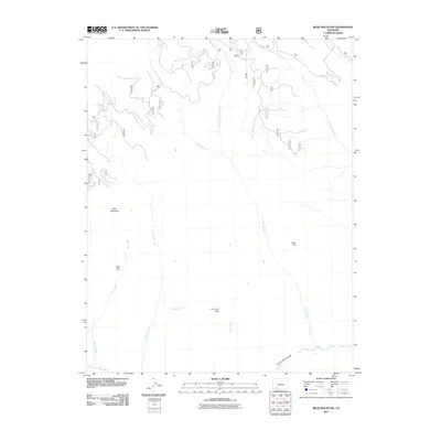
2011 Map of Bear Mountain
USGS Topo · Published 2011About this map
Bear Mountain dominates this portion of the San Juan National Forest, where high-elevation parks and complex drainage systems define the landscape. This 2011 survey illustrates the remote character of the region, featuring Bear Park and Lone Tree Park as significant openings amidst the mountainous terrain. The hydrology is particularly intricate, with Coldwater Creek and Hell Creek feeding south towards the Piedra River, which cuts through the Second Box Canyon at the southern edge of the sheet.
Find a feature on this map
18 named features on this map. Tap any name to fly to it.
Don’t see what you’re looking for? This feature index may not catch every label — zoom into the map to look around manually.
Map Details
Editions of this 2011 Bear Mountain Map
This is the sole edition of this map. No revisions or reprints were ever made.
Other maps of this area

1905 · San Cristobal
USGS Topo · 1:125,000

1907 · San Cristobal
USGS Topo · 1:125,000

1924 · Pagosa Springs
USGS Topo · 1:125,000

1927 · Pagosa Springs
USGS Topo · 1:125,000

1945 · Durango
USGS Topo · 1:250,000

1953 · Durango
USGS Topo · 1:250,000

1954 · Durango
USGS Topo · 1:250,000

1961 · Durango
USGS Topo · 1:250,000

1963 · Durango
USGS Topo · 1:250,000
1964 · Chris Mountain
USGS Topo · 1:24,000