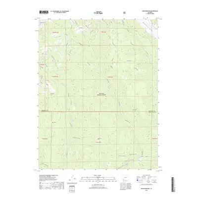
2019 Map of Bear Mountain
USGS Topo · Published 2019About this map
Graham Peak and Bear Mtn anchor the high country where Archuleta and Hinsdale counties meet within the San Juan National Forest. The landscape is defined by a complex drainage system feeding into the Piedra River, which cuts through the southern reaches of this survey. Notable topographic transitions are visible across several geologic benches, including Sand Crk Bench B and Sand Crk Bench E, while the high Sand Divide separates northern watersheds.
Find a feature on this map
34 named features on this map. Tap any name to fly to it.
Don’t see what you’re looking for? This feature index may not catch every label — zoom into the map to look around manually.
Map Details
Editions of this 2019 Bear Mountain Map
This is the sole edition of this map. No revisions or reprints were ever made.
Other maps of this area

1905 · San Cristobal
USGS Topo · 1:125,000

1907 · San Cristobal
USGS Topo · 1:125,000

1924 · Pagosa Springs
USGS Topo · 1:125,000

1927 · Pagosa Springs
USGS Topo · 1:125,000

1945 · Durango
USGS Topo · 1:250,000

1953 · Durango
USGS Topo · 1:250,000

1954 · Durango
USGS Topo · 1:250,000

1961 · Durango
USGS Topo · 1:250,000

1963 · Durango
USGS Topo · 1:250,000
1964 · Chris Mountain
USGS Topo · 1:24,000