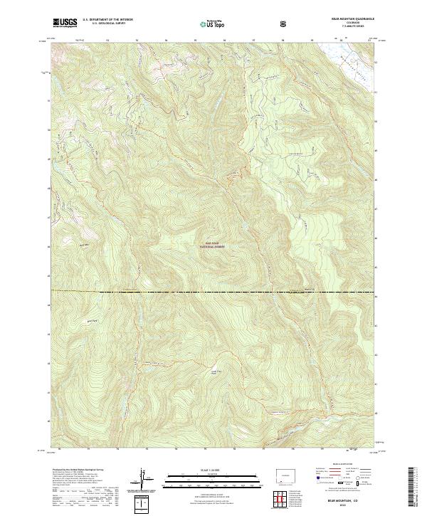
2022 Map of Bear Mountain
USGS Topo · Published 2022About this map
San Juan National Forest defines this high-elevation landscape in the early 21st century, where the headwaters of the Piedra River and its numerous tributaries carve through the terrain. The map traces a complex network of seasonal drainage and historic routes, including the Coldwater Stock Dr Trl and Sand Creek Trl, which navigate the steep elevations between Bear Mountain and the Weminuche Valley. This area serves as a vital corridor for water and transit, as evidenced by the convergence of Weminuche Cr and Little Sand Cr in the northeast. The southern portion of the sheet reveals significant natural landmarks like Second Box Canyon and Lone Tree Park, illustrating the primitive character of the boundary between Hinsdale and Archuleta counties. Researchers can study the established trail systems that have long facilitated movement through these remote forest reaches.
Find a feature on this map
34 named features on this map. Tap any name to fly to it.
Don’t see what you’re looking for? This feature index may not catch every label — zoom into the map to look around manually.
Map Details
Editions of this 2022 Bear Mountain Map
This is the sole edition of this map. No revisions or reprints were ever made.
Other maps of this area

1905 · San Cristobal
USGS Topo · 1:125,000

1907 · San Cristobal
USGS Topo · 1:125,000

1924 · Pagosa Springs
USGS Topo · 1:125,000

1927 · Pagosa Springs
USGS Topo · 1:125,000

1945 · Durango
USGS Topo · 1:250,000

1953 · Durango
USGS Topo · 1:250,000

1954 · Durango
USGS Topo · 1:250,000

1961 · Durango
USGS Topo · 1:250,000

1963 · Durango
USGS Topo · 1:250,000
1964 · Chris Mountain
USGS Topo · 1:24,000